Postcodes UK
Glossary Learn Blog
/

Nations

  • England flagEngland
  • Scotland flagScotland
  • Wales flagWales
  • Northern Ireland flagN. Ireland

Popular counties

  • Devon
  • Somerset
  • Cornwall
  • Kent
  • North Yorkshire
  • Shropshire
  • Highland
  • Lincolnshire
  • Cumbria
  • Norfolk
  • Hampshire
  • Gloucestershire

Major cities

  • London
  • Birmingham
  • Manchester
  • Leeds
  • Glasgow
  • Liverpool
  • Bristol
  • Sheffield

Postcode areas

  • CR0Croydon
  • LE2Leicester
  • E17London
  • LE4Leicester
  • LE3Leicester
  • E14London
  • LE5Leicester
  • BN2Brighton
  • CV6Coventry
  • NW10London
1.8M postcodes 43,000 towns & villages 7.9M property sales 30,000 schools

Lookup

  • Find My Constituency
  • Food Hygiene Ratings
  • Nearest Bus Stops
  • Nearest EV Charging Points
  • Nearest GP Surgery
  • Postcode Area Explorer
  • Postcode District Lookup
  • Postcode Radius Finder
  • School Catchment Finder

Data & Reports

  • Bulk Postcode Lookup
  • Compare Two Postcodes
  • Famous People Near You
  • Postcode Area Report
  • Postcode Density Checker
  • Random Postcode Generator
  • Road Accidents Near You

Property & Money

  • House Prices by Postcode
  • What Can I Afford

Calculators

  • Postcode Distance Calculator
  • Stamp Duty Calculator

Distance

  • Drive Time Calculator
  • Midpoint Finder

Travel

  • Train Station Explorer

Elevation

  • Compare Postcode Elevations
  • Highest & Lowest UK Postcodes
  • Postcode Elevation Lookup
  • Sea Level Rise Postcode Checker

Converters

  • Postcode to Lat/Long

Education

  • Geography Explorer
32 free tools 254 glossary terms View all tools → Glossary →

Press Enter to search for postcodes, places, or streets

Search postcodes, places...
England flagEngland Scotland flagScotland Wales flagWales Northern Ireland flagN. Ireland

Popular counties

Devon Somerset Cornwall Kent North Yorkshire Shropshire

Major cities

London Birmingham Manchester Leeds Glasgow Liverpool Bristol Sheffield

Lookup

  • Find My Constituency
  • Food Hygiene Ratings
  • Nearest Bus Stops
  • Nearest EV Charging Points
  • Nearest GP Surgery
  • Postcode Area Explorer
  • Postcode District Lookup
  • Postcode Radius Finder
  • School Catchment Finder

Data & Reports

  • Bulk Postcode Lookup
  • Compare Two Postcodes
  • Famous People Near You
  • Postcode Area Report
  • Postcode Density Checker
  • Random Postcode Generator
  • Road Accidents Near You

Property & Money

  • House Prices by Postcode
  • What Can I Afford

Calculators

  • Postcode Distance Calculator
  • Stamp Duty Calculator

Distance

  • Drive Time Calculator
  • Midpoint Finder

Travel

  • Train Station Explorer

Elevation

  • Compare Postcode Elevations
  • Highest & Lowest UK Postcodes
  • Postcode Elevation Lookup
  • Sea Level Rise Postcode Checker

Converters

  • Postcode to Lat/Long

Education

  • Geography Explorer
View all tools →
Glossary 254 Teaching Resources Blog
HomeBlogPostcode Data

Postcode Data

Articles filed under Postcode Data

3 Articles
Famous UK Postcodes and the Stories Behind Them
Postcode Data 11 Apr 2026

Famous UK Postcodes and the Stories Behind Them

From Buckingham Palace to Coronation Street, some UK postcodes are more famous than the streets they serve. Here are the stories behind them.

Read More
The UK's Most and Least Dense Postcode Areas
Postcode Data 11 Apr 2026

The UK's Most and Least Dense Postcode Areas

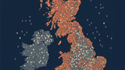
Which parts of the UK pack the most postcodes into the smallest space? We analysed our database of 1.8 million postcodes to find out.

Read More
Why the UK adds around 26,000 New Postcodes Every Year
Postcode Data 14 Mar 2026

Why the UK adds around 26,000 New Postcodes Every Year

Around 26,000 new postcodes are added in the UK each year. Here is why that happens, how quarterly updates work, and why fresh postcode data matters.

Read More
Search
Categories
  • Announcements 1
  • Data 5
  • Data Studies 7
  • Guides 2
  • Places 22
  • Postcode Data 3
  • Property 12
  • UK Geography 4
Recent Posts
Merseyside by the Numbers: Heswall to Liverpool 3 Jul 2026 Reading in Postcodes: Henley to Basingstoke Edge 3 Jul 2026 Brighton in Postcodes: The BN Area by the Numbers 2 Jul 2026 Hertfordshire by the Numbers: Radlett to Harlow 2 Jul 2026 Cheshire by the Numbers: Hale to Ellesmere Port 1 Jul 2026 Leicester in Postcodes: Rutland Edge to the City 1 Jul 2026
Advertisement
PostcodesUK

A free, comprehensive directory of every UK postcode, with property prices, schools, deprivation, transport and local data drawn from trusted official sources.

1.8M postcodes 7.9M property sales 254 glossary terms

Explore

  • England
  • Scotland
  • Wales
  • Northern Ireland

Popular Tools

  • What's My Postcode
  • House Prices by Postcode
  • Compare Two Postcodes
  • School Catchment Finder
  • Nearest GP Surgery
  • View all tools →

Reference

  • Glossary
  • Teaching Resources
  • Blog
  • Change Log

Company

  • About Us
  • Contact
  • Privacy Policy

Data & attributions

This site is built on open public data. We are grateful to the following sources and acknowledge their work.

  • Office for National StatisticsPostcodes, census & geographyOGL v3.0
  • HM Land RegistryPrice Paid DataOGL · Crown ©
  • OpenStreetMapEV chargers & mappingODbL
  • NHSGP & health organisationsOGL
  • Food Standards AgencyFood hygiene ratingsOGL
  • Department for EducationSchools (GIAS)OGL
  • OfstedInspection ratingsOGL
  • National Records of ScotlandScotland censusOGL
  • NISRANorthern Ireland censusOGL
  • Police.uk & Home OfficeCrime dataOGL
  • Ordnance SurveyGrid referencesOGL · OS OpenData
  • Department for TransportTransport & road safetyOGL
  • Scottish & Welsh GovernmentsSIMD & WIMD deprivationOGL
© 2026 Postcodesuk.com. All rights reserved.
Contains public sector information licensed under the Open Government Licence v3.0. Postcode and geographic data © Crown copyright and database right. Map data © OpenStreetMap contributors, licensed under the ODbL.