Postcodes UK
Glossary Learn Blog
/

Nations

  • England flagEngland
  • Scotland flagScotland
  • Wales flagWales
  • Northern Ireland flagN. Ireland

Popular counties

  • Devon
  • Somerset
  • Cornwall
  • Kent
  • North Yorkshire
  • Shropshire
  • Highland
  • Lincolnshire
  • Cumbria
  • Norfolk
  • Hampshire
  • Gloucestershire

Major cities

  • London
  • Birmingham
  • Manchester
  • Leeds
  • Glasgow
  • Liverpool
  • Bristol
  • Sheffield

Postcode areas

  • CR0Croydon
  • LE2Leicester
  • E17London
  • LE4Leicester
  • LE3Leicester
  • E14London
  • LE5Leicester
  • BN2Brighton
  • CV6Coventry
  • NW10London
1.8M postcodes 43,000 towns & villages 7.9M property sales 30,000 schools

Lookup

  • Find My Constituency
  • Food Hygiene Ratings
  • Nearest Bus Stops
  • Nearest EV Charging Points
  • Nearest GP Surgery
  • Postcode Area Explorer
  • Postcode District Lookup
  • Postcode Radius Finder
  • School Catchment Finder

Data & Reports

  • Bulk Postcode Lookup
  • Compare Two Postcodes
  • Famous People Near You
  • Postcode Area Report
  • Postcode Density Checker
  • Random Postcode Generator
  • Road Accidents Near You

Property & Money

  • House Prices by Postcode
  • What Can I Afford

Calculators

  • Postcode Distance Calculator
  • Stamp Duty Calculator

Distance

  • Drive Time Calculator
  • Midpoint Finder

Travel

  • Train Station Explorer

Elevation

  • Compare Postcode Elevations
  • Highest & Lowest UK Postcodes
  • Postcode Elevation Lookup
  • Sea Level Rise Postcode Checker

Converters

  • Postcode to Lat/Long

Education

  • Geography Explorer
32 free tools 254 glossary terms View all tools → Glossary →

Press Enter to search for postcodes, places, or streets

Search postcodes, places...
England flagEngland Scotland flagScotland Wales flagWales Northern Ireland flagN. Ireland

Popular counties

Devon Somerset Cornwall Kent North Yorkshire Shropshire

Major cities

London Birmingham Manchester Leeds Glasgow Liverpool Bristol Sheffield

Lookup

  • Find My Constituency
  • Food Hygiene Ratings
  • Nearest Bus Stops
  • Nearest EV Charging Points
  • Nearest GP Surgery
  • Postcode Area Explorer
  • Postcode District Lookup
  • Postcode Radius Finder
  • School Catchment Finder

Data & Reports

  • Bulk Postcode Lookup
  • Compare Two Postcodes
  • Famous People Near You
  • Postcode Area Report
  • Postcode Density Checker
  • Random Postcode Generator
  • Road Accidents Near You

Property & Money

  • House Prices by Postcode
  • What Can I Afford

Calculators

  • Postcode Distance Calculator
  • Stamp Duty Calculator

Distance

  • Drive Time Calculator
  • Midpoint Finder

Travel

  • Train Station Explorer

Elevation

  • Compare Postcode Elevations
  • Highest & Lowest UK Postcodes
  • Postcode Elevation Lookup
  • Sea Level Rise Postcode Checker

Converters

  • Postcode to Lat/Long

Education

  • Geography Explorer
View all tools →
Glossary 254 Teaching Resources Blog
HomeBlogProperty

Property

Articles filed under Property

12 Articles
Semi-Detached Britain: The Shape of the Suburbs
Property 22 Jun 2026

Semi-Detached Britain: The Shape of the Suburbs

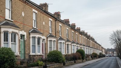
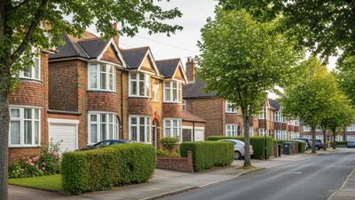
The semi-detached house is the defining home of the British suburb. We mapped where it dominates, and found its heartland in the West Midlands.
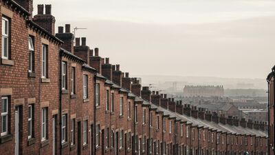
Read More
Terraced Britain: The Postcodes Built in Rows
Property 22 Jun 2026

Terraced Britain: The Postcodes Built in Rows

The terraced house is the workhorse of British housing. We mapped where the rows still dominate, from the mill towns of the north to the valleys of south Wales.
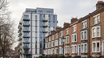
Read More
House or Flat? How Britain Lives, Mapped
Property 21 Jun 2026

House or Flat? How Britain Lives, Mapped

We sorted almost eight million property sales by type to find where flats dominate the market and where the terraced and semi-detached house still rules.

Read More
Million-Pound Postcodes: Where the Money Lives
Property 21 Jun 2026

Million-Pound Postcodes: Where the Money Lives

There have been 265,947 sales of a million pounds or more in England and Wales since 2018. We mapped where they cluster, both by sheer number and by share of the local market.

Read More
Renting Britain: Where Home Ownership Is Rarest
Property 21 Jun 2026

Renting Britain: Where Home Ownership Is Rarest

We mapped Census 2021 housing tenure across every postcode area in England and Wales to find where people are most likely to own their home, and where renting rules.
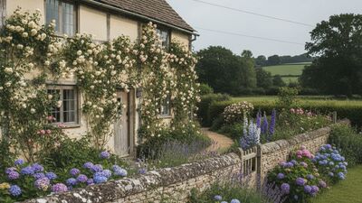
Read More
Rose Cottage Britain: The Most Common House Names
Property 21 Jun 2026

Rose Cottage Britain: The Most Common House Names

Most homes have a number. Millions have a name instead. We counted them across every sale since 2018 to find the most common house names in England and Wales.

Read More
Previous
1 2
Next
Search
Categories
  • Announcements 1
  • Data 5
  • Data Studies 7
  • Guides 2
  • Places 22
  • Postcode Data 3
  • Property 12
  • UK Geography 4
Recent Posts
Merseyside by the Numbers: Heswall to Liverpool 3 Jul 2026 Reading in Postcodes: Henley to Basingstoke Edge 3 Jul 2026 Brighton in Postcodes: The BN Area by the Numbers 2 Jul 2026 Hertfordshire by the Numbers: Radlett to Harlow 2 Jul 2026 Cheshire by the Numbers: Hale to Ellesmere Port 1 Jul 2026 Leicester in Postcodes: Rutland Edge to the City 1 Jul 2026
Advertisement
PostcodesUK

A free, comprehensive directory of every UK postcode, with property prices, schools, deprivation, transport and local data drawn from trusted official sources.

1.8M postcodes 7.9M property sales 254 glossary terms

Explore

  • England
  • Scotland
  • Wales
  • Northern Ireland

Popular Tools

  • What's My Postcode
  • House Prices by Postcode
  • Compare Two Postcodes
  • School Catchment Finder
  • Nearest GP Surgery
  • View all tools →

Reference

  • Glossary
  • Teaching Resources
  • Blog
  • Change Log

Company

  • About Us
  • Contact
  • Privacy Policy

Data & attributions

This site is built on open public data. We are grateful to the following sources and acknowledge their work.

  • Office for National StatisticsPostcodes, census & geographyOGL v3.0
  • HM Land RegistryPrice Paid DataOGL · Crown ©
  • OpenStreetMapEV chargers & mappingODbL
  • NHSGP & health organisationsOGL
  • Food Standards AgencyFood hygiene ratingsOGL
  • Department for EducationSchools (GIAS)OGL
  • OfstedInspection ratingsOGL
  • National Records of ScotlandScotland censusOGL
  • NISRANorthern Ireland censusOGL
  • Police.uk & Home OfficeCrime dataOGL
  • Ordnance SurveyGrid referencesOGL · OS OpenData
  • Department for TransportTransport & road safetyOGL
  • Scottish & Welsh GovernmentsSIMD & WIMD deprivationOGL
© 2026 Postcodesuk.com. All rights reserved.
Contains public sector information licensed under the Open Government Licence v3.0. Postcode and geographic data © Crown copyright and database right. Map data © OpenStreetMap contributors, licensed under the ODbL.