


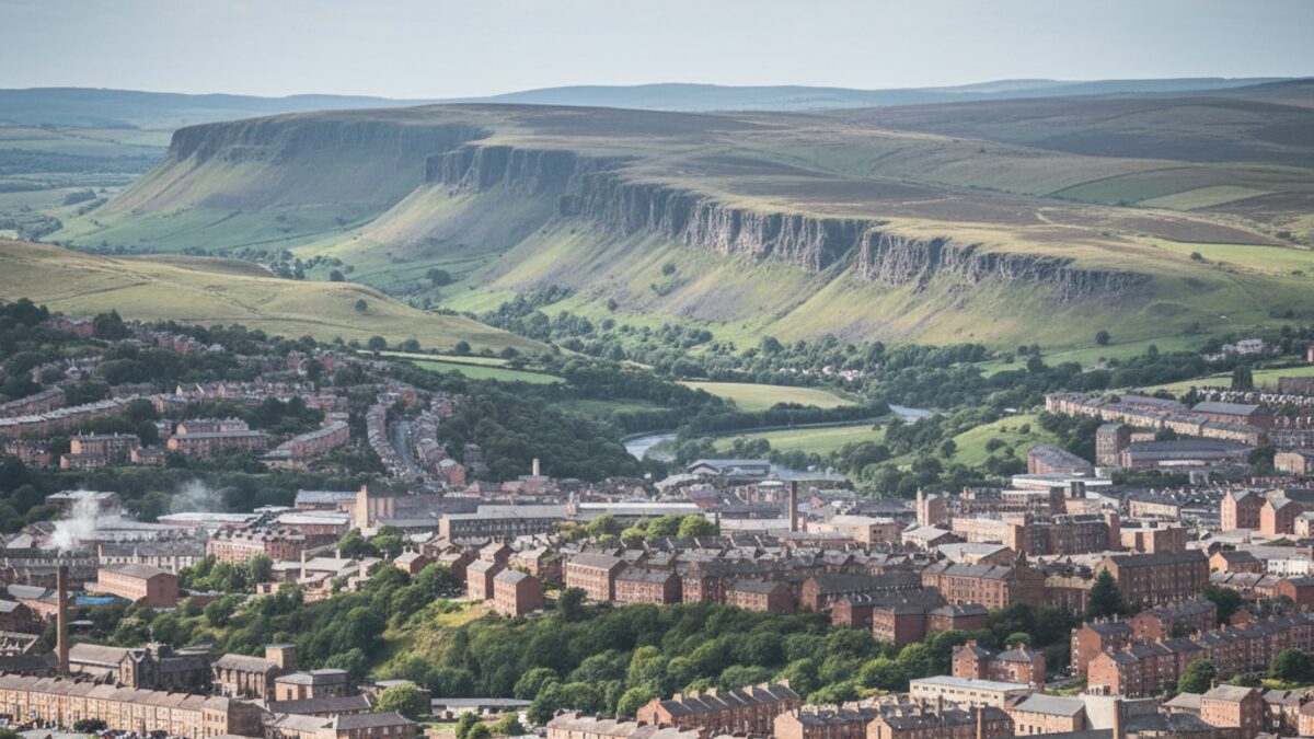
Sheffield is a city of two landscapes. To the west, the steel and concrete give way to the heather moorlands and limestone dales of the Peak District; to the east, the Don Valley still bears the scars and pride of its industrial past. This postcode area, simply the S postcode area, stretches far beyond the city boundaries, taking in market towns and villages that look down on the urban sprawl. It is a postcode patchwork that mirrors the city's famous seven hills, each district with its own character, its own price tag, and its own story.
The numbers tell a tale of contrast. With a population of about 1,389,843 spread across 51 postcode districts, Sheffield is a substantial city region. Yet its average house price of £222,373 sits a full 36 per cent below the England and Wales average. That is not a sign of decline but of geography: much of the city is made up of solid, affordable Victorian terraces and suburban semis, while the most exclusive addresses tuck themselves into the Peak District foothills. The result is a property market that ranges from some of the cheapest urban housing in the country to some of the most desirable rural homes in the north.
At a Glance
Sheffield's postcode area covers the city itself and a wide rural hinterland, including parts of Derbyshire. Across its 51 districts live 1,389,843 people. The average sale price across all districts is £222,373, which is 36 per cent below the England and Wales average. The most expensive district is S32 (Hope Valley), where the average home costs £531,997. The cheapest is S4 (Sheffield), at just £108,895 a gap of nearly five times. Deprivation varies dramatically: the average Index of Multiple Deprivation decile is 4.5 out of 10, with individual districts ranging from 1 (most deprived) to 9 (least deprived). There are 409 Ofsted rated schools in the area, of which 5.1 per cent hold the top grade of Outstanding.
Sheffield at a glance
- Population: about 1,389,843
- Postcode districts: 51
- Average sale price: £222,373 (-36% vs the England and Wales average)
- Schools rated Outstanding: 5.1% (21 of 409)
The Property Divide
The gap between the dearest and cheapest districts in Sheffield is a striking 4.9 times. That is a bigger spread than in many other northern cities, and it reflects the pull of the Peak District. The S32 postcode covers Hope Valley, a spine of chocolate box villages such as Hathersage and Castleton that are gateways to the national park. Buyers pay a premium for stone cottages, valley views and access to trails that lead up to Kinder Scout. At the other end, S4 takes in parts of Burngreave and Pitsmoor, inner city neighbourhoods where the housing stock is older and more deprived. The gap is not just about houses; it is about altitude, both literal and metaphorical.
| Postcode district | Average price | |
|---|---|---|
| Most expensive district | S32 (Hope Valley) | £531,997 |
| Least expensive district | S4 (Sheffield) | £108,895 |
Even within the city itself, the price spread is wide. Districts such as S10 and S11 (Broomhill, Fulwood, Nether Edge) regularly sell for three or four times the cheapest inner city postcodes. But Sheffield remains a relatively affordable city overall. The average price of £222,373 is less than the typical two bedroom flat in many southern towns. For buyers willing to trade a long commute for a lower mortgage, the Sheffield postcode area offers a rare mix of urban convenience and wild edge.
Rich and Poor
Sheffield's deprivation profile is as uneven as its topography. The average Index of Multiple Deprivation decile stands at 4.5, meaning the city as a whole leans towards the more deprived half of England. But the range is wide: from decile 1 in the hardest hit inner city and estate districts to decile 9 in the affluent western suburbs and Peak villages. The poorest districts, such as parts of S2, S3 and S4, suffer from high unemployment, poor health and low educational attainment. Meanwhile, S32 and parts of S10 and S11 enjoy low crime rates, good schools and access to green space. The divide is stark, but there are also many middle income areas, such as S8 and S14, where terraced houses and interwar semis provide solid, unflashy homes for families.
This mix of extremes within a single postcode area is unusual. In many cities, the richest and poorest districts are far apart; in Sheffield, they are often separated by a single hill or a valley. The result is a city where social mixing happens more than the statistics suggest, but where the postcode still betrays a lot about a person's life chances.
Schools
Of the 409 Ofsted rated schools in the Sheffield postcode area, only 5.1 per cent are judged Outstanding. That is below the national average of around 8 per cent, but it masks wide variation. The highest rated schools tend to cluster in the western suburbs: districts like S10 and S11 are home to several Outstanding primaries and secondaries. In the more deprived districts, Outstanding schools are rare, though there are some notable exceptions. The overall figure also reflects the fact that the area includes rural schools in Derbyshire, many of which are rated Good rather than Outstanding. The lesson for parents is clear: the postcode matters for school choice, and the property divide is closely linked to educational opportunity.
The Bottom Line
Sheffield in postcodes is a study in contrasts. From the grit of S4 to the glory of S32, the price gap of nearly five times shows a city where a postcode can determine not just your address but your access to green space, good schools and opportunity. Yet the city as a whole remains a relative bargain, with average prices 36 per cent below the national benchmark. For those willing to look beyond the obvious, Sheffield offers a rare combination: the energy of a large city and the quiet of the Peak District, all within a few miles. The postcode area is not uniform, and that is its strength. Whether you are buying a terrace in Burngreave or a cottage in Hope Valley, you are buying into a place that is proud, complex and never dull.