Postcodes UK
Glossary Learn Blog
/

Nations

  • England flagEngland
  • Scotland flagScotland
  • Wales flagWales
  • Northern Ireland flagN. Ireland

Popular counties

  • Devon
  • Somerset
  • Cornwall
  • Kent
  • North Yorkshire
  • Shropshire
  • Highland
  • Lincolnshire
  • Cumbria
  • Norfolk
  • Hampshire
  • Gloucestershire

Major cities

  • London
  • Birmingham
  • Manchester
  • Leeds
  • Glasgow
  • Liverpool
  • Bristol
  • Sheffield

Postcode areas

  • CR0Croydon
  • LE2Leicester
  • E17London
  • LE4Leicester
  • LE3Leicester
  • E14London
  • LE5Leicester
  • BN2Brighton
  • CV6Coventry
  • NW10London
1.8M postcodes 43,000 towns & villages 7.9M property sales 30,000 schools

Lookup

  • Find My Constituency
  • Food Hygiene Ratings
  • Nearest Bus Stops
  • Nearest EV Charging Points
  • Nearest GP Surgery
  • Postcode Area Explorer
  • Postcode District Lookup
  • Postcode Radius Finder
  • School Catchment Finder

Data & Reports

  • Bulk Postcode Lookup
  • Compare Two Postcodes
  • Famous People Near You
  • Postcode Area Report
  • Postcode Density Checker
  • Random Postcode Generator
  • Road Accidents Near You

Property & Money

  • House Prices by Postcode
  • What Can I Afford

Calculators

  • Postcode Distance Calculator
  • Stamp Duty Calculator

Distance

  • Drive Time Calculator
  • Midpoint Finder

Travel

  • Train Station Explorer

Elevation

  • Compare Postcode Elevations
  • Highest & Lowest UK Postcodes
  • Postcode Elevation Lookup
  • Sea Level Rise Postcode Checker

Converters

  • Postcode to Lat/Long

Education

  • Geography Explorer
32 free tools 254 glossary terms View all tools → Glossary →

Press Enter to search for postcodes, places, or streets

Search postcodes, places...
England flagEngland Scotland flagScotland Wales flagWales Northern Ireland flagN. Ireland

Popular counties

Devon Somerset Cornwall Kent North Yorkshire Shropshire

Major cities

London Birmingham Manchester Leeds Glasgow Liverpool Bristol Sheffield

Lookup

  • Find My Constituency
  • Food Hygiene Ratings
  • Nearest Bus Stops
  • Nearest EV Charging Points
  • Nearest GP Surgery
  • Postcode Area Explorer
  • Postcode District Lookup
  • Postcode Radius Finder
  • School Catchment Finder

Data & Reports

  • Bulk Postcode Lookup
  • Compare Two Postcodes
  • Famous People Near You
  • Postcode Area Report
  • Postcode Density Checker
  • Random Postcode Generator
  • Road Accidents Near You

Property & Money

  • House Prices by Postcode
  • What Can I Afford

Calculators

  • Postcode Distance Calculator
  • Stamp Duty Calculator

Distance

  • Drive Time Calculator
  • Midpoint Finder

Travel

  • Train Station Explorer

Elevation

  • Compare Postcode Elevations
  • Highest & Lowest UK Postcodes
  • Postcode Elevation Lookup
  • Sea Level Rise Postcode Checker

Converters

  • Postcode to Lat/Long

Education

  • Geography Explorer
View all tools →
Glossary 254 Teaching Resources Blog
HomeBlogPlaces

Places

Articles filed under Places

22 Articles
Nottingham in Postcodes: Southwell to the City
Places 30 Jun 2026

Nottingham in Postcodes: Southwell to the City

A data portrait of Nottingham: 1,224,637 people across 31 postcode districts, average prices, the cheapest and dearest corners, deprivation and schools.

Read More
West Midlands by the Numbers: Solihull to Wolverhampton
Places 30 Jun 2026

West Midlands by the Numbers: Solihull to Wolverhampton

A data portrait of West Midlands: 3,051,871 people across 94 postcode districts, average prices, the cheapest and dearest corners, deprivation and schools.
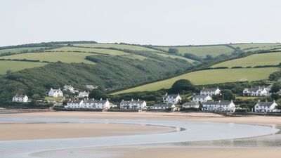
Read More
Devon by the Numbers: Salcombe to Plymouth
Places 29 Jun 2026

Devon by the Numbers: Salcombe to Plymouth

A data portrait of Devon: 1,321,054 people across 67 postcode districts, average prices, the cheapest and dearest corners, deprivation and schools.

Read More
Newcastle in Postcodes: Ponteland to the Tyne
Places 29 Jun 2026

Newcastle in Postcodes: Ponteland to the Tyne

A data portrait of Newcastle: 1,194,876 people across 64 postcode districts, average prices, the cheapest and dearest corners, deprivation and schools.
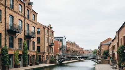
Read More
Bristol in Postcodes: Harbour to Suburb
Places 28 Jun 2026

Bristol in Postcodes: Harbour to Suburb

A data portrait of Bristol: 1,034,255 people across 39 postcode districts, average prices, the cheapest and dearest corners, deprivation and schools.

Read More
Lancashire by the Numbers: Coast, Mills and Moors
Places 28 Jun 2026

Lancashire by the Numbers: Coast, Mills and Moors

A data portrait of Lancashire: 1,922,303 people across 52 postcode districts, average prices, the cheapest and dearest corners, deprivation and schools.

Read More
Previous
1 2 3 4
Next
Search
Categories
  • Announcements 1
  • Data 5
  • Data Studies 7
  • Guides 2
  • Places 22
  • Postcode Data 3
  • Property 12
  • UK Geography 4
Recent Posts
Merseyside by the Numbers: Heswall to Liverpool 3 Jul 2026 Reading in Postcodes: Henley to Basingstoke Edge 3 Jul 2026 Brighton in Postcodes: The BN Area by the Numbers 2 Jul 2026 Hertfordshire by the Numbers: Radlett to Harlow 2 Jul 2026 Cheshire by the Numbers: Hale to Ellesmere Port 1 Jul 2026 Leicester in Postcodes: Rutland Edge to the City 1 Jul 2026
Advertisement
PostcodesUK

A free, comprehensive directory of every UK postcode, with property prices, schools, deprivation, transport and local data drawn from trusted official sources.

1.8M postcodes 7.9M property sales 254 glossary terms

Explore

  • England
  • Scotland
  • Wales
  • Northern Ireland

Popular Tools

  • What's My Postcode
  • House Prices by Postcode
  • Compare Two Postcodes
  • School Catchment Finder
  • Nearest GP Surgery
  • View all tools →

Reference

  • Glossary
  • Teaching Resources
  • Blog
  • Change Log

Company

  • About Us
  • Contact
  • Privacy Policy

Data & attributions

This site is built on open public data. We are grateful to the following sources and acknowledge their work.

  • Office for National StatisticsPostcodes, census & geographyOGL v3.0
  • HM Land RegistryPrice Paid DataOGL · Crown ©
  • OpenStreetMapEV chargers & mappingODbL
  • NHSGP & health organisationsOGL
  • Food Standards AgencyFood hygiene ratingsOGL
  • Department for EducationSchools (GIAS)OGL
  • OfstedInspection ratingsOGL
  • National Records of ScotlandScotland censusOGL
  • NISRANorthern Ireland censusOGL
  • Police.uk & Home OfficeCrime dataOGL
  • Ordnance SurveyGrid referencesOGL · OS OpenData
  • Department for TransportTransport & road safetyOGL
  • Scottish & Welsh GovernmentsSIMD & WIMD deprivationOGL
© 2026 Postcodesuk.com. All rights reserved.
Contains public sector information licensed under the Open Government Licence v3.0. Postcode and geographic data © Crown copyright and database right. Map data © OpenStreetMap contributors, licensed under the ODbL.