



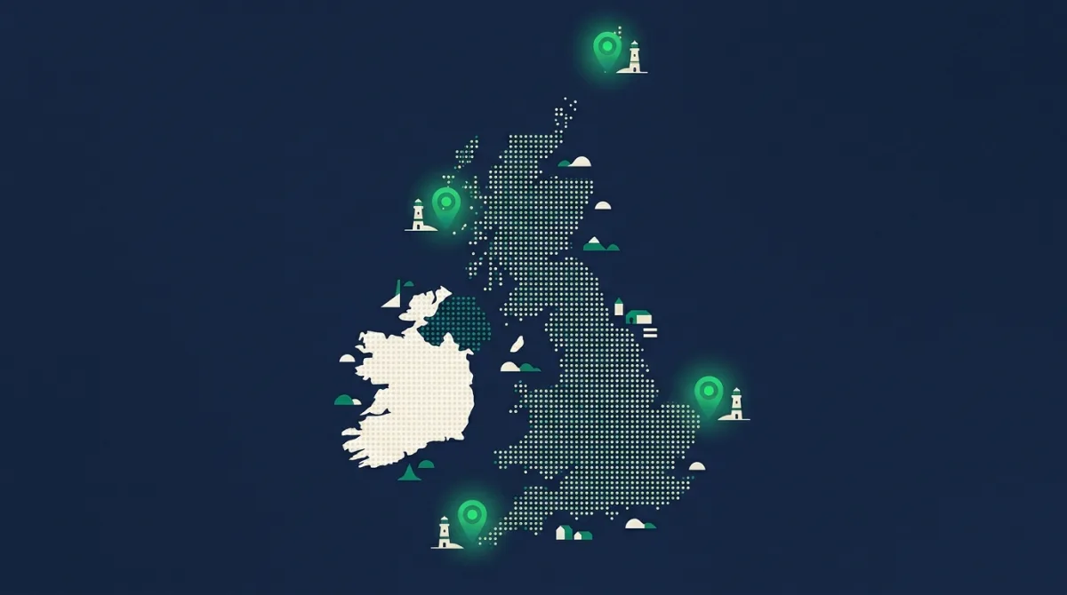
Somewhere in the UK, a postman delivers to the most northerly letterbox in the country. Someone else covers the most southerly, the most easterly and the most westerly. We ran the coordinates of 1.8 million postcodes to find out exactly where those four rounds end.
North: ZE2 9EQ, Unst, Shetland
The northernmost postcode in the UK sits at latitude 60.8 on the island of Unst in Shetland, along the B9086 near Skaw. This is further north than Stockholm, Oslo and the southern tip of Greenland. In midsummer the sky here never gets properly dark; in midwinter the sun manages less than six hours. The nearest railway station is over 300 miles away by sea and road.
South: TR22 0PL, St Agnes, Isles of Scilly
Six hundred and seventy nautical miles to the south, the last postcode in the country belongs to Old Lane on St Agnes, the southernmost inhabited island of the Isles of Scilly. St Agnes has around 70 residents, a pub, and a milder climate than anywhere else in Britain. Palms and agapanthus grow outdoors here in January.

East: NR32 1UZ, Lowestoft
The most easterly postcode in the UK is Gas Works Road in Lowestoft, Suffolk, a few steps from Ness Point, the official easternmost spot of the British mainland. It is a working street of yards and industrial units rather than a beauty spot, which feels very East Anglian: the country ends not with a lighthouse but with a gas works. Sunrise arrives here before anywhere else in Britain.
West: BT93 3DJ, County Fermanagh
The westernmost postcode is Manger Road in rural County Fermanagh, hard against the border near Belleek, the village famous for its pottery. It is further west than parts of Portugal. If you restrict the contest to Great Britain alone, the honour passes to the Outer Hebrides, but on a full UK map Fermanagh takes it comfortably.
And the middle: a Watery Lane near Coventry
Here is the one nobody guesses. Take all 1.8 million postcodes, find the median latitude and the median longitude, and the postcode nearest that crossing point is CV7 8AJ: Watery Lane, on the rural fringe of Coventry. Half of Britain's postcodes lie north of it, half south, half east, half west.
This is a statistical centre rather than a geometric one, and it is pulled south by where people actually live. The geometric centre of the landmass sits far further north, in Lancashire or beyond depending on how you measure. But as a centre of gravity for British addresses, a quiet lane in the Midlands is about as fitting as it gets.
How we worked it out
Coordinates come from the centroid of each live postcode in our database, filtered to the UK's bounding box to exclude a handful of miscoded entries. North, south, east and west are simply the extreme latitude and longitude values. The centre is the postcode closest to the median latitude and median longitude of all 1.8 million points, which is why it reflects population rather than landmass. You can check any postcode's exact coordinates with our postcode to lat/long tool.